
ICICI Bank recently announced the usage of satellite data—imagery from Earth observation satellites—to assess credit worthiness of its customers belonging to the farm sector. The Bank is the first in India and among few globally to use satellite data to measure an array of parameters related to the land, irrigation and crop patterns and use it in combination with demographic and financial parameters to make expeditious lending decisions for farmers. This use of innovative technology helps farmers with existing credit to enhance their eligibility, while new-to-credit farmers can now get better access to credit. Additionally, since the land verification is done in a contactless manner with the help of satellite data, credit assessments are being done within a few days as against the industry practice of upto 15 days.
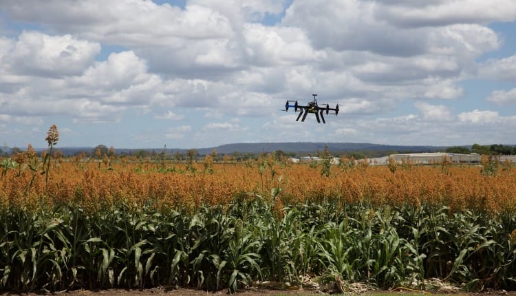
The Bank has been using satellite data for the past few months in over 500 villages in Maharashtra, Madhya Pradesh and Gujarat and plans to scale up the initiative to over 63,000 villages shortly across the country. This initiative gains significance at a time when people are advised to stay indoors and avoid travel in the wake of the Coronavirus pandemic. This use of satellite data provides quick and technically sound analysis of the land, crop and irrigation patterns from remote locations, without the need of the customer or a bank official having to visit the land. It offers farmers the significant advantage of reliable data being provided to the Bank without any hassles of travel, operational or logistical expenditure to them.
Commenting on this new initiative, Anup Bagchi, Executive Director, ICICI Bank, said, “ICICI Bank has a legacy of pioneering innovations in technology to create propositions that provide increased convenience to customers. We have created new paradigms in the financial services industry by taking the lead in introducing path breaking innovations including firsts like internet banking in 1998, mobile banking (2008), Tab banking (2012), 24×7 Touch Banking branches (2012), Software Robotics (2016) and Blockchain deployment (2016).
We are bringing forth yet another futuristic technology of using satellite data and analysis to provide key inputs for credit assessments for lending to farmers. Earlier, one had to visit remote locations to manually assess a host of parameters on the land location, irrigation levels and crop quality patterns to forecast future revenues of the farmers. Now, imagery from earth observation satellite gives us ground-breaking ability to track many information across large areas in a contactless and highly reliable manner. This, combined with demographic and financial details, provides strong information on the land asset of the farmers. We believe that usage of this technology will enhance accessibility to credit as new-to-credit farmers will have easy access to formal credit, as well as farmers with existing credit lines will be able to securely expand their eligibility. With encouraging response to our pilot project in over 500 villages, we will shortly cover over 63,000 villages in the country for lending with this technology.”
The Bank has partnered with agri–fintech companies specialising in harnessing space technology and weather information for commercial usage. It has worked closely with them to build reports with over 40 parameters for assessing credit-worthiness of a farmer with deep study of the land, irrigation and crop patterns. The analysis is put together using algorithms to analyse images available from satellites around the planet. Additionally, the Bank has worked on further scoring models to create indices at district level, village level as well as for individual land to provide an estimate of the past and future agriculture income, the timing of harvest and sources of income, and thus, provide key inputs to credit assessments.
Some of the key satellite data being used by the Bank are:
· Rainfall and temperature data of past years
· Soil moisture levels in past years
· Surface water availability
· Trends in crop sowing including crop name, tentative sowing & harvesting weeks, crop health and yields
· Agriculture land location details including latitude, longitude and boundary of the land
· Nearby locations of warehouses and mandis
This innovative technology will help farmers, who are existing customers of the Bank as well as non-customers, to avail KCC (Kisan Credit Card) loans. KCC attributed one-third to the Bank’s rural loan portfolio of Rs 571.77 billion in the quarter ended June 30, 2020.