
The future of infrastructure monitoring: From manual surveys to AI-powered geospatial solutions
By Amit Sharma, Founder and Whole Time Director at Matrix Geo Solutions
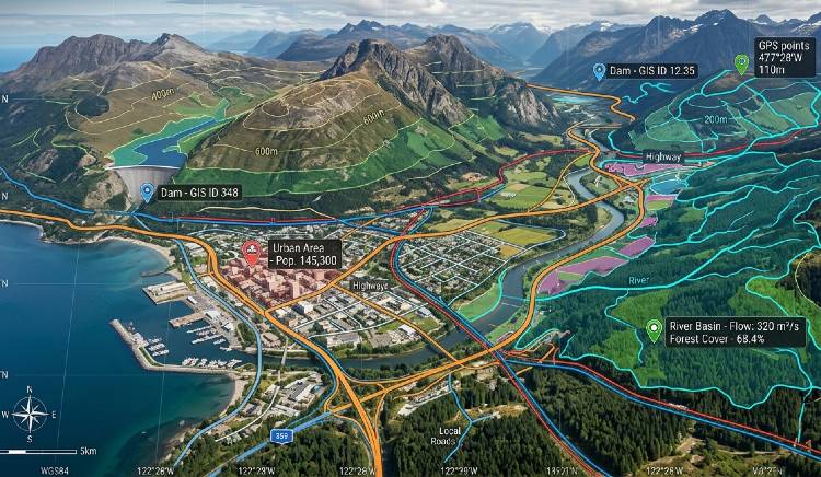
Infrastructure is the physical spine that drives economic growth. Roadways, railways, bridges, dams, electrical lines, and oil and gas pipelines keep countries functioning. But there has been little advancement in terms of how these assets are managed. Human-led surveys, inspection rounds, and physical inspection of assets have been the norm for decades now. It is an effective method but one that is time-consuming, costly, and less accurate at times. In a world where infrastructure is expanding fast and aging at the same time, old methods are no longer enough. A new era is unfolding. It is driven by geospatial intelligence, artificial intelligence, and connected systems.
Past Limitations
Infrastructure monitoring involved human labor. Engineers used to visit sites, look for any visible flaws and damages, measure wear levels, and generate reports. It was a viable approach at a time when infrastructure was smaller and more disconnected. In modern times, the situation is different. Infrastructure has expanded greatly, covering enormous geographies, urban areas, industries, and transport routes. Such infrastructure cannot be monitored manually; small cracks may be overlooked, ground movement will remain unnoticed, and the process of action will be delayed because of it.
This task becomes harder as infrastructure ages. They tend to deteriorate, and this process is accelerated by climate changes and higher demands that utilities have to withstand. Continuous monitoring becomes necessary, but traditional approaches cannot deliver such results. Geospatial systems become crucial in such conditions.
Spatial Shift
Geospatial technology is fast emerging as an important pillar in the Indian digital revolution. It aids in turning disorganized and haphazard information into organized and intelligent data. It leads to better planning, implementation, and monitoring. Miniaturization of sensors, improved analytics, cloud computing, and advanced remote sensing have revolutionized the domain. It is easier to collect and process the information now.
The policy climate in India has aided the shift as well. Geospatial data, remote sensing data, and drones are increasingly being made accessible thanks to progressive policies. This will aid in the transition of geospatial intelligence from specialized use to the domain of infrastructure planning. As per data, India’s geospatial market can reach one lakh crore rupees by 2030.
Rise of GeoAI
The emergence of GeoAI represents the next step in this progression. GeoAI incorporates artificial intelligence with geolocation data in order to develop systems capable of not only identifying events, but doing so with an understanding of their spatiality and importance. Location itself becomes imbued with meaning, such that a crack in a dam wall takes on a completely different connotation than a crack in a roadside barrier.
This capability extends in both space and time. GeoAI monitors the evolution of conditions throughout days, months, or even years. Satellite imagery, drone imaging, IoT, GPS, digital mapping, and field surveys all contribute to one system. Computer vision detects defects. Deep learning identifies patterns in difficult-to-decipher terrain. Predictive modeling forecasts future risk. This transforms infrastructure monitoring from mere maintenance into foresight.
Digital Mirror
Perhaps one of the strongest implementations of geospatial AI is the digital twin. This is a live computer representation of a tangible object. It reflects the actual situation and updates in real time. An engineer no longer needs to be physically present at the location to evaluate a bridge, a tunnel, or a highway. They can virtually apply stress and test their results.
The use of augmented reality and immersive visualization technologies takes this one step further. The use of interactive dashboards and 3D visualization helps make sense of complicated information. A maintenance manager knows about any changes right away. A city planner can test how the new road will perform before building. This not only saves time but also increases certainty.
Impact on Economy
Geospatial AI affects more than just inspection process. There are fundamental economic changes that come out of it. Cost reduction is one example. More efficient routing decreases fuel consumption in fleet management. Space analysis saves money on facilities. More intelligent scheduling helps eliminate inefficiencies and need for overtime work. Just drone inspections can decrease cost of infrastructure inspections by up to forty percent compared to conventional inspection methods.
Road Ahead
Infrastructure monitoring in the future is not going to be based on individual inspection alone. The future is about interconnected intelligence. Global infrastructure assets are rapidly aging and under increasing pressure at the same time. According to the OECD, the world will require nearly 6.9 trillion dollars in annual infrastructure investment through 2050 to support economic growth and climate resilience. Geo-spatial artificial intelligence holds the key. Infrastructure becomes visible, measurable, and predictable with it. It gives the capability to make decisions early and to save money too. Manual surveys are essential but their importance would be different. They will be a small part of an enormous intelligence system. The real future lies in seeing infrastructure not as static assets, but as living systems that can think, adapt, and endure.